Global Politics
UGANDA: WAR LOOM OVER APPA, GOVERNMENT REPORT SAYS STAY THE PLANS TO RELOCATE OR EVICT PEOPLE FROM APAA
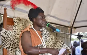
A hundred years ago, West Nile wasnot part of Uganda. Today, it is the onlysub-region in Uganda with an Englishname and a history as chequered, as it isinteresting. John Peter Andrua, 82, the first African information officer of West Nile and former BBC stringer could not agree any more, he says the history of West Nile is enchanting and may well come as a surprise to those who think they know the region well.
The veteran journalist and former teacher, who joined the ministry of information in 1964 says previously the sub-region was known as West Nile Province and then West Nile District. According to Sharon Onyiru, the chairperson of the committee organising the centenary celebrations, it was once “leased for life to King Leopold II of Belgium as a pleasure-hunting ground because the place was full of wild animals.” King Leopold lies interestingly, in order to acquire Congo and subsequently ‘West Nile’,
King Leopold lied to the international community. He set up a private holding company disguised as an international scientific and philanthropic association, which he called the International African Society or the International Association for the Exploration and Civilisation of the Congo.
After some diplomatic maneuvering, which resulted in the Berlin Conference
on African affairs, the Congo Free State, 46 NEW VISION, Monday, April 7, 2014
WEST NILE @ 100 West Niler The THE BIGSTORY
which was 76 times larger than Belgium, was granted to King Leopold II. He controlled the vast area with a private army known as the Force Publique.
Part of Sudan Previously, however, West Nile was part
of the Lado Enclave and its main town was not Arua in Uganda, but Lado, a river
port in southern Sudan. A British-Congolese Treaty in 1894 leased the region to
King Leopold II for life. When Leopold died on December 22, 1909, the region reverted to the British, the following year,”
Onyiru says. Ernest Lulua, 87, a retired teacher, chief and former magistrate in the region during the colonial era is in agreement that West Nile was indeed part of Sudan before
it reverted to Belgian Congo and finally to Uganda.
According to Harold Acemah, a political scientist and retired career diplomat, the Lado Enclave consisted of territory, which today forms part of northern Uganda and
south eastern Sudan. “It was part of the Congo Free State until 1910 when it reverted to Anglo- Egyptian control, as per the
Anglo-German Treaty of 1890,” Acemah says. Available literature also indicates that
during the first decade of the 20th century, the British sought by force to establish total
control over southern Sudan. To achieve this, the Sudan-Uganda border was delimited in 1913 and amended in 1914, when Sudan ceded the southern tip of the Lado Enclave, known
Parliamentary Select committee on Apaa report finally come out
7. The conflict betuteen |IWA and residents of Apaa
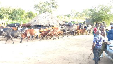
The conflict in Apaa within the Reserve is between the residents who claim
customary ownership of the land and UWA that has the mandate to manage all
the wildlife reserves. It was on this basis that UWA moved in to evict the people
who had settled in the Wildlife Reserve. The eviction was resisted leading to
confrontation.
2. Border dispute between Amunt and Adjumani
The border dispute between Adjumani and Amuru and encroachment of the
East Madi Wild Reserve started in 2OO7. This culminated into a meeting of
Amuru and Adjumani district leaders, UWA, and other stakeholders (Annex
vru.
Arising out of the meeting, a joint request to the Rt. Hon. Prime Minister by
the Chairperson Local Government V of Amuru and Adjumani was written on
20ft of November 2OO7 for an urgent intervention to have a border re-opening
exercise carried out and the encroachment on the Reserve stopped (Annex
IXl. This request however was not acted on immediately, and the rise in
tensions due to the unresolved border issue ensued.
The District leaders from the two districts conducted joint consultative
meetings in Gulu on the 22″d of January 2015, where a joint team was set up
to sensitize the community on the planned boundary re-opening. The
sensitization was carried out between 4th – 6th March,2015 in the areas of
Zoka and Apaa trading center, with the objective of informing them about the
planned border re-opening and demarcation. (Annex X).
In 2017, a border re-opening exercise was undertaken by the Ministry of
Lands, Housing, and Urban Development, and a declaration was made by the
Minister of Local Government on 13ft October 20 17. The boundaries that were
reopened are described as follows;
W Page | ).2
1. District Boundary
iCommencing at the point uthere the Riuer Choro enters the Albert Nile;
thence in a straight line in a north-easterlg direction to the source of the
Riuer Ceri”
2. East Madi CHA
lCommencing at the confluence of the Riue Asiga uith the Albert Nile,
thence following in turn to northern banks of the riuers Asiya and Ofoa
to the source of the latter; thence easterly in a straight line to the top of
the Arawa Hill; thence in a straigltt line to the junction of tLrc Okwa and
Eradzi riuers; thence along the east bank of the Eradzi Riuer to its
source; thence easterlg direction in a straight line to the source of the
Umuu Riuer; thence following the north bank of the Umuu Riuer to its
confluence with Cei Riuer whiclt is at this point the Madi-Acholi District
boundary; thence following the Madi-Acholi District boundary in a
southerlg then westerlg direction to the Albert Nile Riuer; thence
following the Albert Nile to the point of the commencement.”l4aaen__Xll
It is worth noting that the representatives of the Acholi community did not
participate in the exercise, and rejected its outcome alleging that it was in
contravention of the High Court order in Miscellaneous application No.004
of 2Ol2 that issued an injunction against the Uganda Wildlife Authority and
Attorney General and their agents or servants from any eviction,
destruction, confiscation or conversion and or interfering with the land
rights, occupation and the uses of the land belonging to the applicants in
the areas of Lakang, Pabbo and Apaa in Amuru District.
Besides they were skeptical about the series of the maps used suspecting
them of having been altered.
The A
‘-